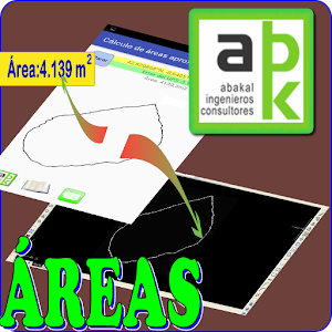
You can download from Google Play-Store an Android application that will allow us to measure areas "in situ" with our Android device and export them to dxf (CAD)
 |
| Descargar programa |
Instrucciones de uso:/Instructions for use:
La primera pantalla que nos aparecerá será la siguiente:
The first screen that will appear to us will be the following one

Obviamente deberemos tener GPS y estar activado. Si no ocurre esto el programa nos avisará.
Continuando. Pulsamos el botón GPS tal como nos indica el programa:
Obviously we must have GPS and this be enabled. If this does not happen the program will notify us.
Continuing. Press the GPS button as indicated by the program:

Conviene esperar hasta que se reduzca al máximo el error:
It is advisable to wait until the error was reduced to the maximum


When we have a little mistake, press in "Mark" and begin the walk around the outside perimeter of the plot we want to measure:

Cuando le demos a parar nos aparecerá el siguiente mensaje:
When we press stop, the following message will appear:
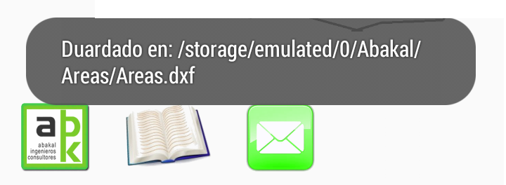
Y en el directorio marcado estará nuestro archivo dxf por si quisiéramos usarlo en nuestro programa CAD:
And in the marked folder will be our dxf file in case we want to use it in our CAD program:

NOTAS:
Dado que es un método aproximado y depende de la exactitud del GPS de nuestro móvil, no hay que esperar milagros sólo una medida cercana a la realidad.
Campo abierto da mejores resultados que en medio de una ciudad. Los edificios interfieren con la señal del GPS.
Es recomendable andar despacio al recorrer el perímetro. Cuantos más puntos obtenidos se mejora la exactitud y además se le permite al GPS acertar mejor con la situación en dónde estamos.
NOTES:
It is an approximate method and depends on the accuracy of the GPS of our mobile, not to expect miracles only a measure close to reality.
Open field gives better results than in the middle of a city. Buildings interfere with the GPS signal.
It is advisable to walk slowly as you go around the perimeter. The more points obtained, the accuracy is improved and the GPS is also enabled to better match the situation where we are.
Top application. Merci merci bien... 100% march
ResponderEliminar